
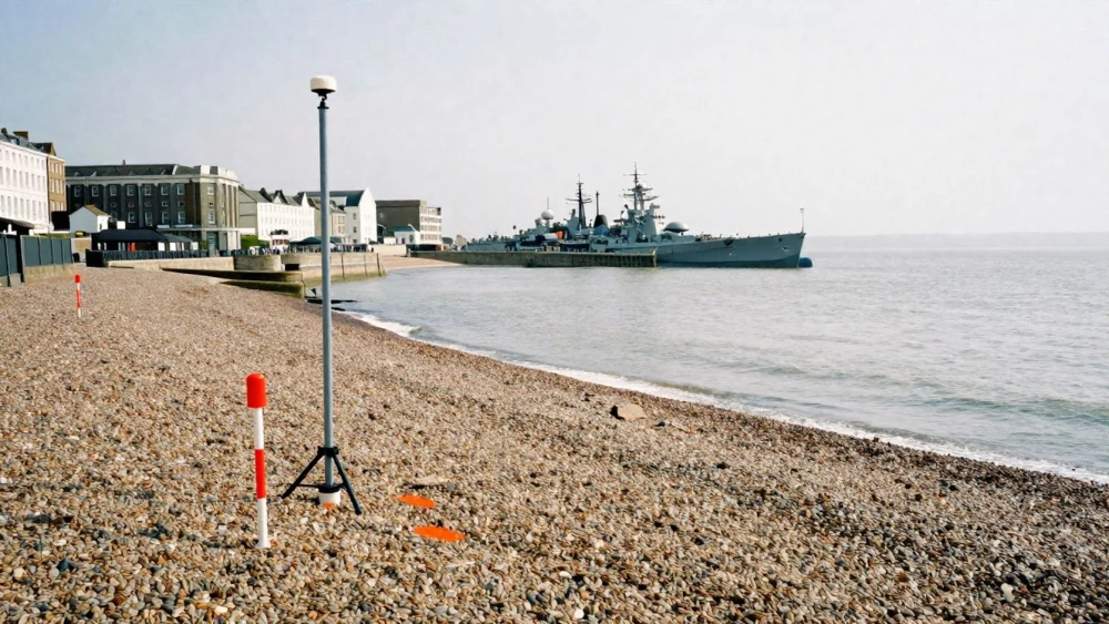
GPS Surveys
Get in TouchAt Portsmouth Surveys, we specialise in delivering precise GPS surveys . Our team employs advanced GPS technology for a wide range of applications, from construction to land development.
We provide accurate data on spatial positioning and topography, ensuring your project is based on reliable information. Our expertise helps in project planning, minimising potential challenges, and optimising resource allocation.
Whether you're a developer, architect, or engineer, our GPS surveys offer the precision you need.
How Much Do GPS Surveys Cost?
GPS surveys typically cost between £400 and £800. The price varies depending on factors such as the size and complexity of the site, the level of detail required, and any specific regulatory needs.
For instance, sites with dense urban features might require advanced GPS equipment like Real-Time Kinematic (RTK) systems for high centimetre-level accuracy. Additionally, drone integration can be used for aerial surveys, particularly valuable for expansive properties like industrial estates or farmland, reducing on-ground time.
Larger or more challenging sites will require more resources and time, potentially increasing costs. Projects requiring additional data processing or alignment with standards such as ISO 9001 for quality management can also influence the price.
For a detailed quote tailored to your project's specifics, get in touch with us today.
What Are the Benefits of GPS Surveys?
GPS surveys provide numerous benefits, ensuring your project is backed by precise data. They use satellite signals to achieve centimetre-level accuracy, making them ideal for projects that require detailed spatial information.
Key advantages include:
Accuracy: High precision data on spatial positioning through real-time kinematic (RTK) and standard GPS techniques.
Time Efficiency: Faster data acquisition compared to traditional methods, reducing survey durations from days to mere hours.
Versatility: Applicable to various projects, including construction, mapping, and land development. They are particularly useful for topographic surveys and boundary delineations.
Cost-Effectiveness: Saves resources by reducing potential site-related issues and the need for repeated site visits.
Reliability: Provides consistent performance under most weather conditions, making it suitable for different terrains and remote locations.
These advantages make GPS surveys a crucial tool for precise land measurements. Contact us to see how our GPS surveys can benefit your project.
How Long Do GPS Surveys Take?
The duration of a GPS survey depends on the size and complexity of the survey area. Typically, smaller surveys can be completed within a day, while larger or more intricate sites may take two to three days.
Factors such as weather conditions and access to the site can also impact the timeline. Additionally, the type of GPS equipment used, such as dual-frequency GNSS receivers, can influence the speed and accuracy of our measurements.
Compliance with standards like ISO 17123 ensures precise and reliable data collection. We meticulously plan surveys, considering topographical challenges and proximity to infrastructure.
This careful preparation allows us to deliver efficient and timely results, ensuring minimal disruption to your schedule. If you have specific site needs, feel free to contact us for a tailored estimate.
Why Choose Portsmouth Surveys for GPS Surveys?
Choosing Portsmouth Surveys for your GPS surveys in means opting for expertise and reliability. We employ advanced real-time kinematic (RTK) systems to achieve centimetre-level accuracy, essential for precision in construction and engineering projects.
Our team is experienced in using cutting-edge GPS technology to deliver highly accurate results. We cater to various industries, including construction, architecture, and development, ensuring every survey matches the client's needs.
We adhere to the latest RICS guidance, guaranteeing that our surveys meet professional standards. We also offer post-processing services using software like Leica Geo Office, to refine and verify data, enhancing the reliability of your project plans.
Our commitment to quality and detail ensures your project runs smoothly from start to finish. Reach out today to see how our GPS survey expertise can benefit your development plans.
Frequently Asked Questions
How do I book a GPS survey with Portsmouth Surveys?
To book a GPS survey, simply contact our team via phone or through our website. We'll discuss your requirements and guide you through the next steps.
Are GPS surveys affected by weather conditions?
Yes, weather conditions can impact the accuracy of GPS signals. We plan our surveys to minimise this, using the best available techniques to ensure reliable results.
Can GPS surveys be used in urban areas?
Absolutely, GPS surveys are effective in both urban and rural settings. We have the capabilities to manage any urban challenges that may arise.
What information will I receive from a GPS survey?
A GPS survey provides detailed data on spatial coordinates, elevation, and topography, supporting informed decision-making in your projects.
Do you offer any other types of surveys?
Yes, alongside GPS surveys, we offer a variety of land and topographic surveying services. Contact us to learn more about our full range of options.
Get a Free Quote for GPS Surveys
For reliable and accurate GPS surveys , get in touch with Portsmouth Surveys today.