
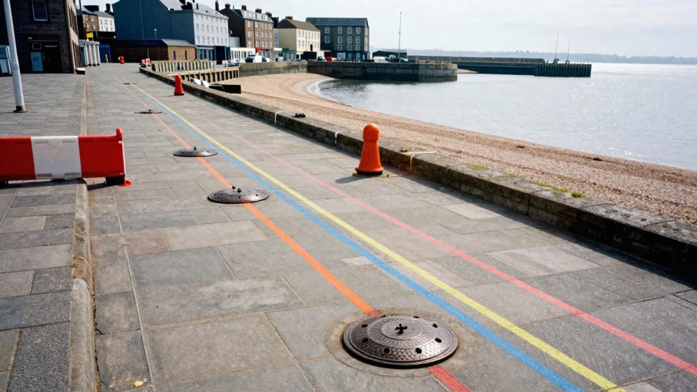
Utility Mapping Surveys
Get in TouchAt Portsmouth Surveys, we conduct utility mapping surveys to identify and document underground utilities such as electrical cables, gas pipelines, and water mains. Our techniques include ground-penetrating radar (GPR) and electromagnetic location, ensuring precise mapping.
We cater to construction companies, architects, and local councils, delivering clear and comprehensive utility maps that help prevent costly project delays. Contact us today to discuss your requirements and request a quote.
How Much Does Utility Mapping Cost?
Utility mapping typically costs between £350 and £700 per survey. This pricing depends on factors like site size, complexity, and survey detail required.
Our experienced team uses ground-penetrating radar (GPR) and electromagnetic locators to ensure comprehensive and accurate mapping of subsurface utilities. Factors such as the depth and density of utilities, as well as accessibility issues, can influence the final cost.
We adhere to PAS 128 standards, which ensure the precision and reliability of our surveys. Detailed topographical surveys may also be integrated to provide a complete view of surface and subsurface features.
Our utility mapping helps prevent costly utility strikes during construction by providing detailed information on existing infrastructure. For a more precise quote, please get in touch with our specialists today.
Book Utility Mapping Surveys Today
How Does Utility Mapping Work?
Utility mapping involves several critical steps to ensure accurate detection and documentation.
Pre-survey planning: We gather existing records and client specifications.
Site reconnaissance: Our team visits the site to assess conditions and access.
Data collection: We use ground-penetrating radar and electromagnetic location equipment.
Data processing and interpretation: Collected data is analysed to produce detailed utility maps.
Report generation: We provide you with a detailed utility mapping report.
For more details on our processes and how we can help your project, contact us today.
What Are the Benefits of Utility Mapping?
Utility mapping offers numerous advantages by revealing hidden underground infrastructures. Our surveys employ techniques such as Ground Penetrating Radar (GPR) and Electromagnetic Location (EML), ensuring accurate detection of various utility types.
By investing in utility mapping, you can expect:
Improved safety: Minimises the risk of utility strikes during excavation, adhering to industry standards such as PAS 128.
Cost efficiency: Reduces project delays and associated costs by avoiding unforeseen utilities.
Accurate planning: Enhances project design by providing precise utility locations, vital for infrastructure projects.
Environmental protection: Decreases the likelihood of hazardous leaks or spills, safeguarding the surrounding ecosystem.
Our expertise is suited for residential, commercial, and industrial clients looking to safeguard their projects. Reach out to Portsmouth Surveys to realise these benefits on your next project.
Why Choose Portsmouth Surveys for Utility Mapping Surveys?
Choosing Portsmouth Surveys for your utility mapping needs ensures quality and reliability. We employ advanced electromagnetic locators and ground-penetrating radar (GPR) to detect and map underground utilities with precision.
Our team meticulously follows industry standards such as PAS 128 to ensure compliance and accuracy in all our surveys.
We have experience collaborating with diverse clients, from construction firms to municipal bodies, addressing unique requirements for various project types. Our utility surveys help identify potential conflicts early, minimising costly project delays or safety hazards.
Moreover, we provide detailed reports that include georeferenced data and 3D visualisations, making complex information easily understandable.
Trust us to deliver timely, precise surveys that enhance your project's success . Contact us today to discuss your specific utility mapping needs.
Speak to a Utility Mapping Surveys Expert
Frequently Asked Questions
How long does a utility mapping survey take?
A typical utility mapping survey may take one to three days, depending on site size and complexity.
Can utility mapping surveys detect all types of utilities?
Yes, we can locate various utilities, including electricity, gas, water, and telecommunications using detecting equipment.
How do you ensure the accuracy of utility mapping surveys?
We use advanced equipment and experienced professionals to deliver high-precision results.
Are there any limitations to utility mapping?
Utility mapping may be challenging in areas with dense infrastructure or electromagnetic interference, but our techniques help mitigate these issues.
Is utility mapping necessary before construction begins?
Yes, utility mapping is crucial for preventing utility strikes and ensuring project safety and efficiency.
Get a Free Quote for Utility Mapping Surveys
To explore our utility mapping services, contact Portsmouth Surveys today. Our team is ready to provide you with a detailed quote and expert advice.